About the Project
The QUT ARC Mars VR Project is a research initiative aimed at making the science of NASA's Mars 2020 Perseverance Mission accessible and engaging to broader audiences through virtual reality.
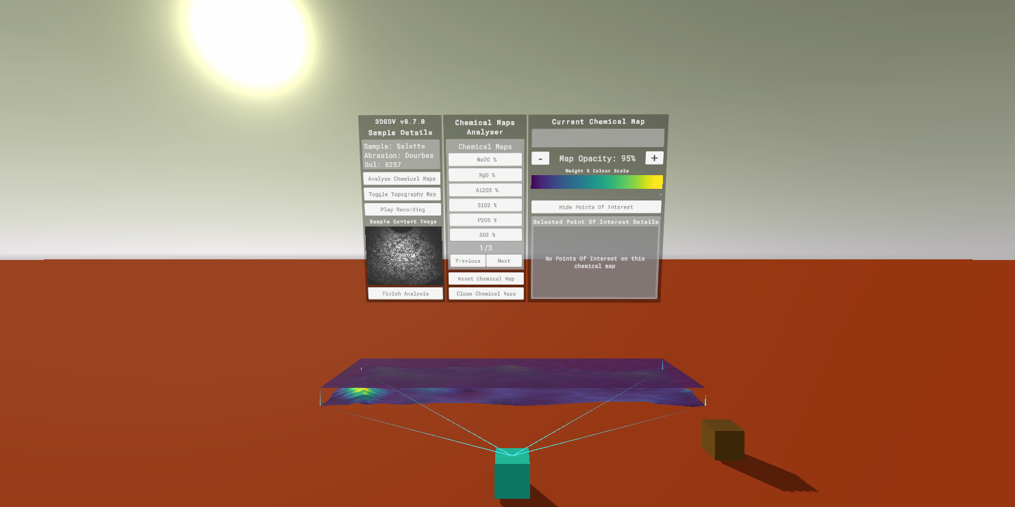
My central contribution as Research Assistant was designing and building a 3D Geological Data Visualisation System - a VR interface that allows users to examine the chemical compositions of rock samples collected by the Perseverance Rover on the Martian surface.
The data was extracted from PIXLISE, a database of results from the PIXL (Planetary Instrument for X-ray Lithochemistry) instrument aboard Perseverance. I reformatted this data into interactive 3D visualisations that users of ARC Mars VR can explore and understand in VR.
The project spans two versions of the 3DGDV system, each refining the user experience and expanding the depth of geological data accessible in VR.
My Process
Early Concept & Research
My involvement began with understanding what the project was actually working with. I researched NASA's Mars 2020 Perseverance Mission - specifically the PIXL (Planetary Instrument for X-ray Lithochemistry) instrument and a software developed by Peter Nemere utilsing the data called PIXLISE. PIXL analyses the chemical composition of rocks on the Martian surface, with that data being taken into PIXLISE which then represents those compositions as chemical maps, giving us a way to interpret the data visually.
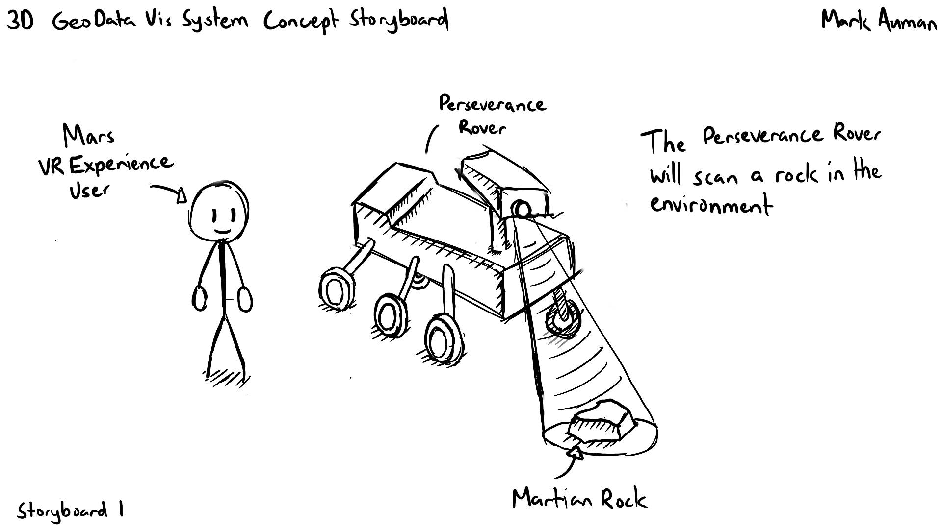
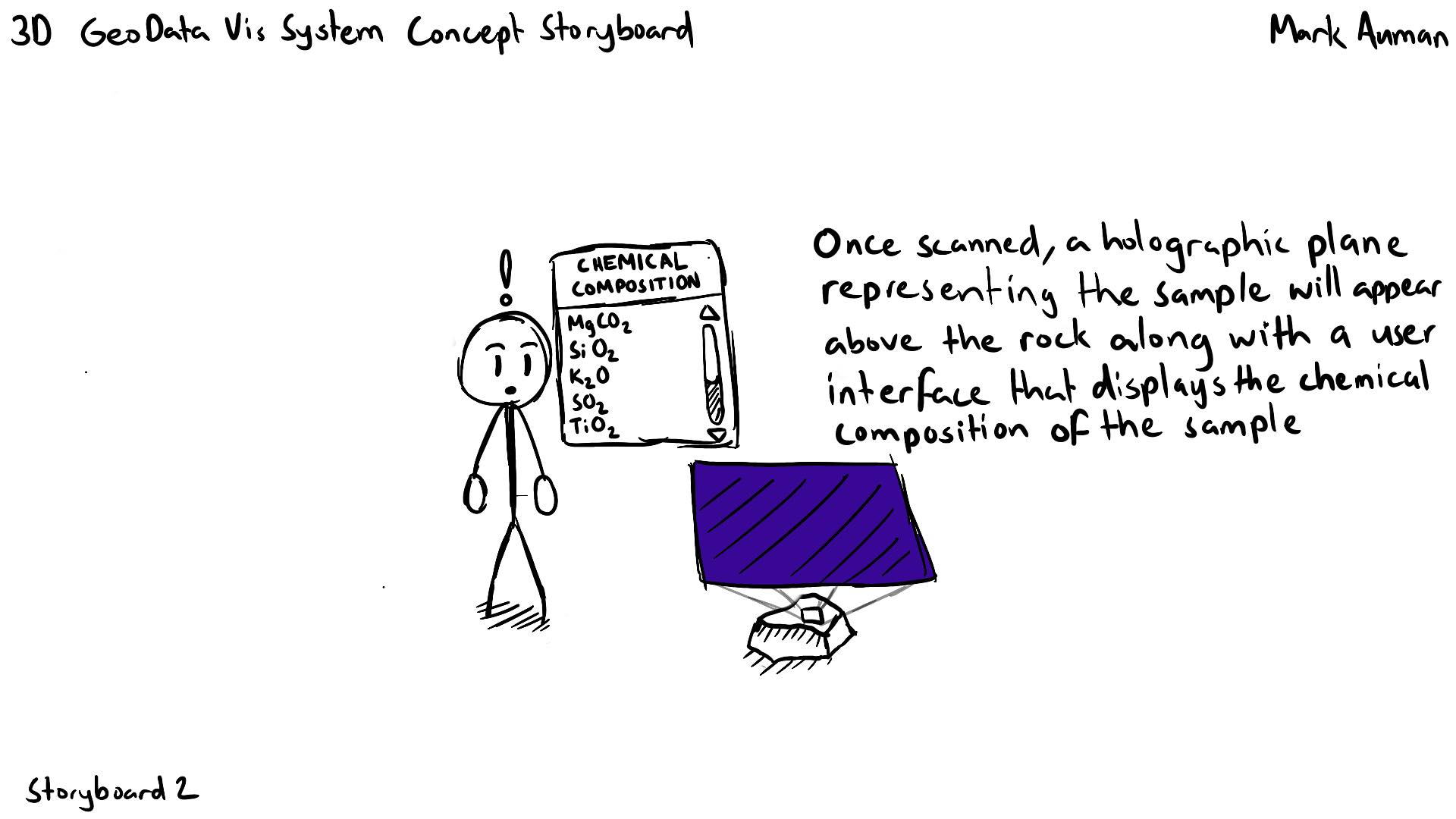
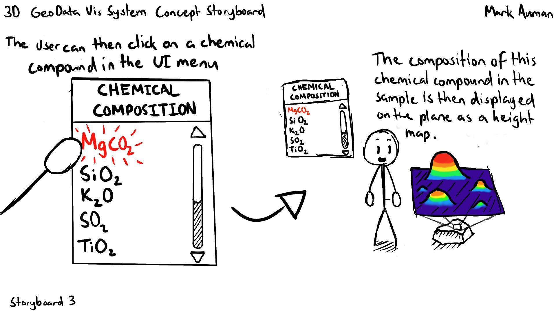
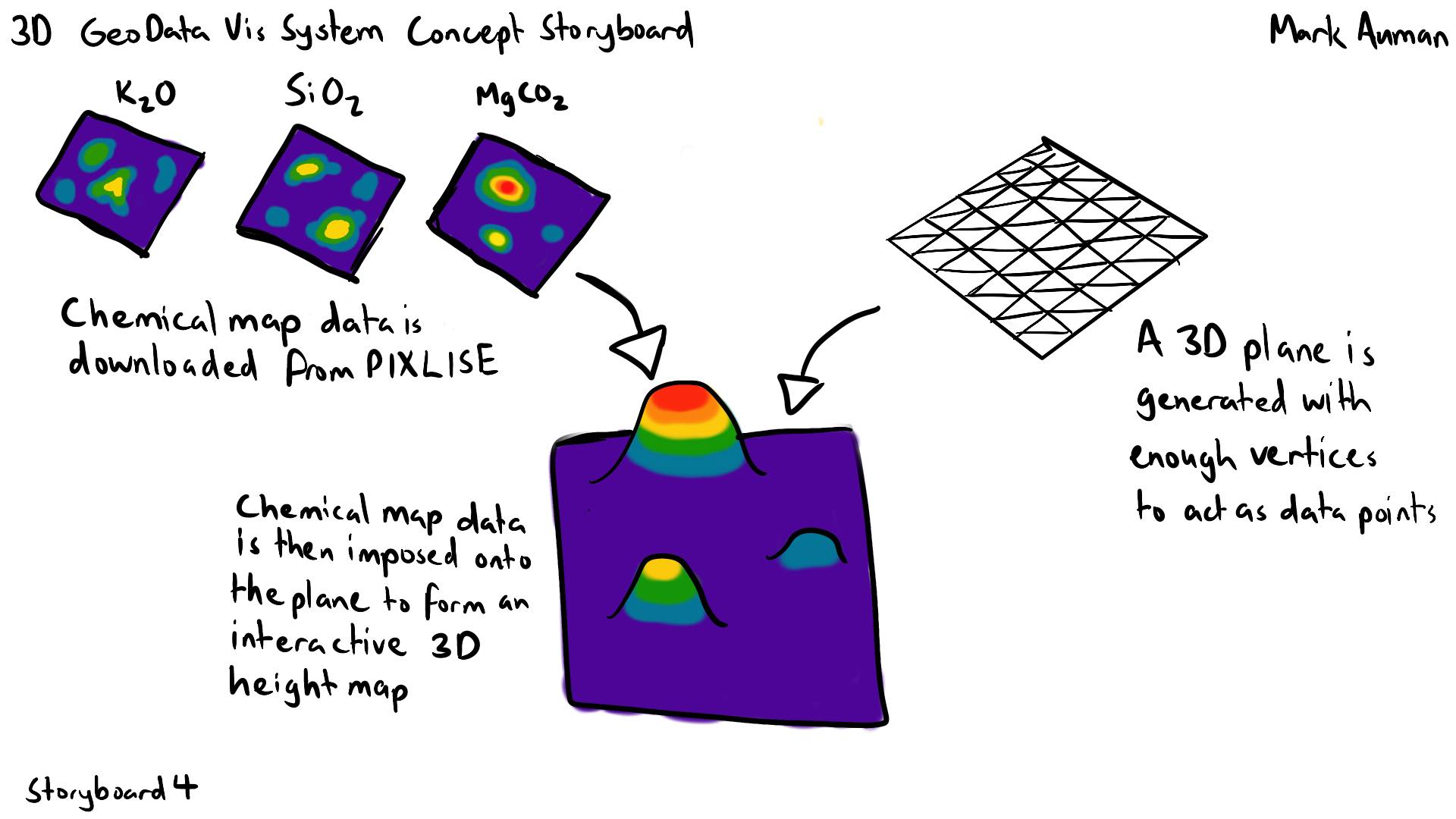
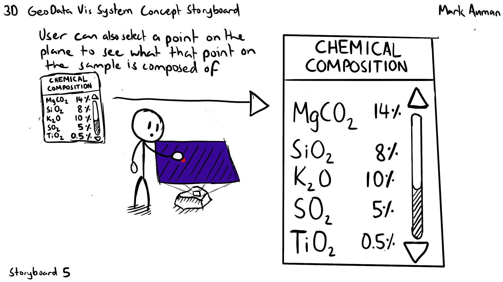
From that research, the concept for the 3D Geological Data Visualisation system emerged: a VR experience where scanning a rock sample brings up an interactive 3D chemical map. Users can select individual elements within that map to isolate and explore the sample's composition in three dimensions - making scientific data that would otherwise require specialist software more accessible and appealing to a general audience.
3DGDV Development
Development of the 3D Geological Data Visualisation (3DGDV) system was iterative, built in Unity using OpenXR. I adapted the visualisation to work inside a VR environment - allowing users to physically move around and interact with the data in ways a flat screen simply cannot replicate.
Features were added progressively, often in direct response to feedback from geologists at QUT who were advising on what information would be most useful. These included: a Point of Interest (POI) system for annotating chemical maps; the ability to grab, scale, and reposition maps within the environment; context images showing a real photograph of the rock sample being examined; and a topology map layer with chemical map overlays so users could correlate chemical data with the physical structure of the rock.
Over the course of development the system was refined into a reusable package so that it could be imported and used within the larger ARC Mars VR Project.
Outcomes
This was my first experience contributing to a larger project mid-development, where I was joining an existing codebase with established systems and design decisions already in place. Learning to design and develop under those constraints, rather than building from scratch, was a different challenge and one that reflects the reality of most professional development environments.
The project also gave me experience applying Unity in a context entirely removed from games - as a platform for scientific data visualisation with real educational and research value. Viewing the work through the lens of what a geologist or member of the public would actually take away from it shaped design decisions under a different lens to what I was used to in game development.